 PT
PT
 ES
ES
 EN
EN
We can't find the internet
Attempting to reconnect
Something went wrong!
Hang in there while we get back on track
About
Foundation
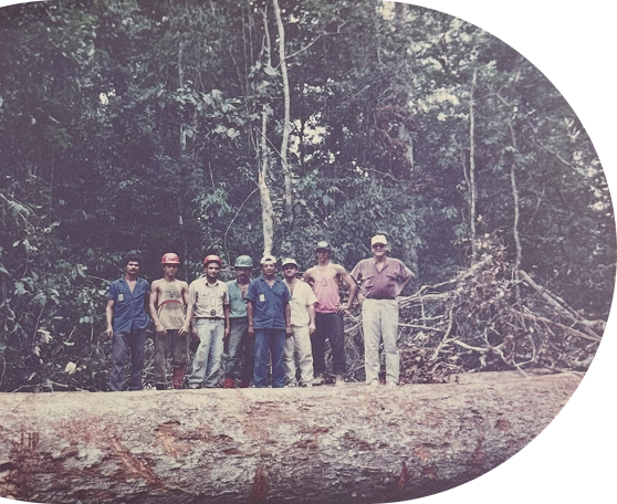
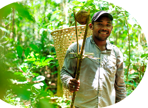
Development of the first forest management demonstration project in the Amazon, which was conducted in a 250-hectare area in Paragominas (Pará State) between 1993 and 1994. The results and publications from that initiative have made it possible for the region to currently boast more than 3 million hectares under management.
 © Embrapa Acre
First workshop on community forest management in the Amazon, which promoted the exchange of experiences among 12 mapped-out initiatives. This was the starting point for the region to have more than 1,500 traditional community projects almost a decade later, in 2007.
Research conducted in partnership with the World Bank on the dynamics of boom-bust cycles served as a reference for the development of public policies to combat deforestation and create conservation units in the Amazon.
Studies contributed to the National Forest Program (PNF) and the National System of Nature Conservation Units (SNUC).
Research on the ecology of mahogany - the most valuable tropical wood at the time - was essential for its inclusion in the list of endangered species of the Convention on International Trade of Endangered Wild Fauna and Flora Species (CITES).
Publication of a series of studies in partnership with the UN Food and Agriculture Organization (FAO).
 (c) Ibama/Reproducao
Direct involvement in the creation of the Mahogany State Forest (Flota) in Acre State, covering 143,897 hectares.
 © Rafael Araújo/Imazon
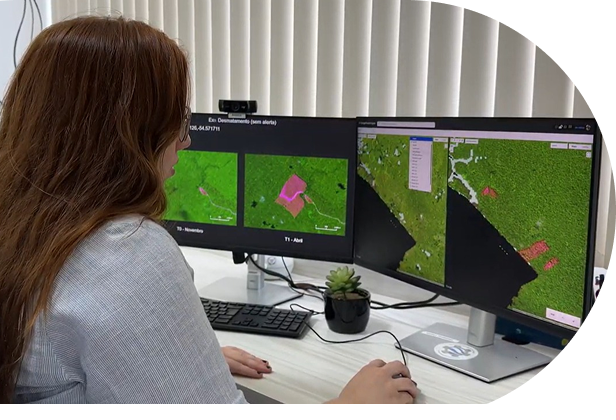
The Normalized Difference Fraction Index (NDFI), developed in 2003 by researcher Carlos Souza Jr., was officially launched to the scientific community, after field validation, through an article published in the journal Remote Sensing of Environment. This index has been used to monitor forest degradation in the Pan-Amazon region and other biomes and has already been used in more than 50 scientific articles worldwide.
Technical support for the creation of 13 Conservation Units (CUs), totaling approximately 22 million hectares. Out of these, six were in partnership with the government of Pará: the State Forests (Flotas) of Faro, Iriri, Paru, and Trombetas, the Grão-Pará Ecological Station (Esec) — the largest tropical conservation area on the planet — and the Maicuru Biological Reserve (Rebio), which together cover 13 million hectares. The other seven were in partnership with the federal government, in Amazonas and Pará, along the BR-163 highway: the Amanã, Crepori, Jamanxim, and Trairão National Forests (Flonas), the Jamanxim and Rio Novo National Parks (Parnas), and the Tapajós Environmental Protection Area (APA), which cover 6.4 million hectares. In addition, Imazon contributed technical information for the creation of approximately 3 million hectares of state conservation units in southern Amazonas State.
Research on the forestry sector and forest concessions contributed decisively to the drafting of the new Public Forest Management National Law (11.284/2006).
 © Márcio Nagano/Flota de Faro
Participation in the creation of the Amazonian Network of Georeferenced Socio-Environmental Information (Raisg).
Unprecedented partnership with the Federal Public Prosecutor's Office (MPF) and State Public Prosecutor's Offices (MPEs) to monitor illegal deforestation in protected areas in the states of Pará, Mato Grosso, Amapá, and Roraima.
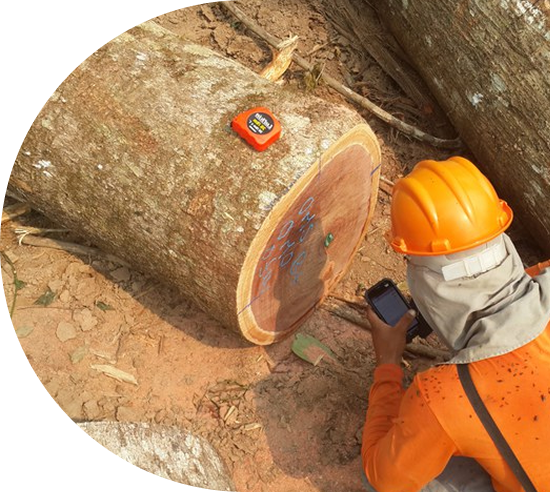
Development of the Timber Harvesting Monitoring System (Simex), a pioneering tool in the world for detecting timber extraction and assessing the lawfulness of such activity.
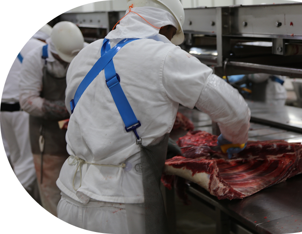
A study on livestock ranching contributed to the creation of a resolution by the National Monetary Council (CMN), which requires environmental and land compliance for credit concessions in the Amazon.
Release of the Green Municipality Program in the city of Paragominas, in Pará State. This initiative resulted in a drastic reduction in deforestation and a significant increase in the Rural Environmental Registry (CAR). As a result, the municipality was the first to be removed from the Ministry of the Environment and Climate Change's (MMA) critical deforestation list.
Release of the Deforestation Alert System (SAD), which monitors deforestation and forest degradation throughout the Legal Amazon on a monthly basis using satellite imagery. Developed since 2006, this was the first remote monitoring initiative of this kind undertaken by civil society anywhere in the world.
Estudo sobre pecuária contribuiu para a criação de uma resolução do Conselho Monetário Nacional (CMN), que exige a regularidade ambiental e fundiária para as concessões de crédito na Amazônia.
Auxílio ao Ministério Público Federal (MPF) na elaboração do Termo de Ajustamento de Conduta (TAC) da pecuária no Pará, conhecido como "TAC da Carne". Esse instrumento foi fundamental para a maior fiscalização da cadeia e o aumento do (CAR)
Alem disso, o Imazon contribuiu com informacoes tecnicas para a criacao de cerca de 3 milhoes de hectares de UCs estaduais no Sul do Amazonas.
Studies on the Environmental Crimes Law have contributed to the improvement of strategies to combat deforestation. Among them are changes to speed up the donation of seized assets and the dissemination of the list of embargoed properties.
 © Ideflor-Bio
Publications contributed to the creation of the Federal Program for Community and Family Forest Management (PMCF).
Imazon was one of the key institutions in the “Open Letter from Brazilian Companies” in favor of a climate agreement at the Copenhagen Climate Conference, COP-15. This initiative was recognized by the Secretary-General of the United Nations (UN) as one of the most important in the preparatory phase to the event.
 © Rafael Araújo/Imazon
Partnership with Google to develop the Deforestation Alert System (SAD) on the Earth Engine (EE) platform.

Support for the creation of the Juruena and Campos Amazônicos national parks in southern Amazonas State, covering a total area of approximately 3 million hectares.
Co-leader of the “Green Livestock” project in the city of Paragominas (Pará State), which aimed to expand good production practices, animal welfare, and working conditions in the sector.
Support for the design and implementation of Pará State's Green Municipalities Program (PMV). The public policy was applied in 105 of the 144 cities in the state, covering approximately 1 million km² and benefiting more than 5 million people. As a result, municipalities in Pará State were removed from the Ministry of the Environment and Climate Change's (MMA) critical deforestation list.
Pioneering work monitoring deforestation in settlements in the Amazon contributed to the creation of the Green Settlements Program by the National Institute of Colonization and Agrarian Reform (Incra).
Partnership with the Instituto Centro de Vida (ICV) to implement the Timber Harvesting Monitoring System (Simex) in Mato Grosso State.
 © Rafael Araújo/Imazon
 © EBC
© EBC
Participation in the release of the Greenhouse Gas Emissions and Removals Estimation System (SEEG), the first initiative of its kind in the hemisphere. Imazon was responsible for updating emissions estimates from the land use change sector for all biomes in Brazil.
Support for the design and implementation of Pará State's Illegal Deforestation List (LDI).
Preparation of the Management Plan for Utinga State Park in the city of Belém (Pará State). With an average of 40,000 visitors per month, the park is currently one of the most visited conservation units in the Amazon.
Publication of the first report based on the Social Progress Index (SPI) at the subnational level worldwide, which measured the quality of life in all 772 municipalities in the Legal Amazon, called “IPS Amazônia.” New publications were released in 2018, 2021, and 2023. Starting in 2024, the data began to be released annually through IPS Brazil.
Imazon's Deforestation Alert System (SAD) was one of the inspirations for the World Resources Institute (WRI) in building the Global Forest Watch (GFW) platform, a deforestation monitoring tool that, for the first time, provided real-time access to satellite images, maps, and crowdsourcing of the world's forests.
Contribution to the development and implementation of the Sustainable Territories Program in the municipalities of Oriximiná, Terra Santa, and Faro, in northern Pará State, covering a total area of 120,000 km².
 © Márcio Nagano/Imazon
 © Márcio Nagano/Imazon
Development of the Integrated Environmental Management System (Sigam), which assists in the decentralization of municipal environmental management.
Leading role in the design and development of the MapBiomas network, which aims to map out changes in land use and land cover in Brazil on an annual basis.
Creation of the Community Environmental Agents Program (AAC), in partnership with Pará state's Institute for Forest and Biodiversity Development (Ideflor-Bio). The initiative has already trained more than 100 volunteers to lead environmental protection and education actions in the state.
 © Vitória Leona/Imazon
Release of FloreSer, a system for monitoring secondary vegetation in the Amazon available on Google Earth Engine (GEE).
Studies have contributed recommendations for the implementation of the National Plan for the Recovery of Native Vegetation (Planaveg), whose goal is to restore at least 12 million hectares of forest by 2030.
Research helped develop the Land Registration and Regularization System (Sicarf), launched by the Pará State’s Land Institute (Iterpa).
Direct support in the creation of the Jará Environmental Protection Area (APA), located in the city of Juruti (Pará state). The municipal conservation unit covers 4,850 hectares.
Release of the Portal Proteja, the largest digital library on protected areas in Brazil, in partnership with other institutions.
 © Márcio Nagano/Imazon
Amazon 2030 project launched in partnership with other institutions to create an economic and social development plan for the region. The initiative has already benefited from the contribution of more than 120 renowned researchers and published more than 80 studies.
Creation of the Simex Network, comprising Imazon, ICV, Idesam, and Imaflora, with the aim of mapping timber extraction throughout the Legal Amazon on an annual basis and assessing the legality of the activity in states with public management plans.
Technical coordination of the MapBiomas Água platform, which monitors the country's water surface.
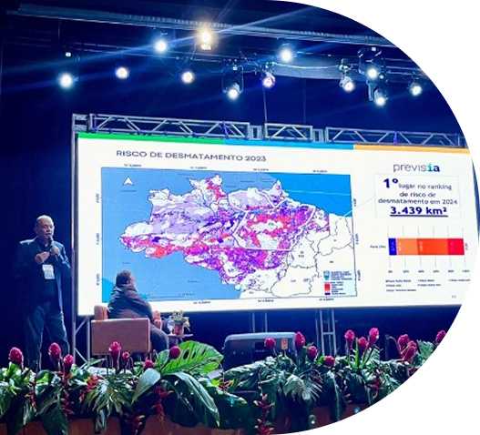
Release of PrevisIA, a platform that uses artificial intelligence to identify areas at highest risk of deforestation in the Legal Amazon.
Support for the expedition that found the largest tree in the Amazon and the fourth largest in the world, in the Paru State Forest (Flota), in northern Pará. It is a red angelim tree 88.5 meters tall, equivalent to almost 2.5 times the size of Christ the Redeemer (in Rio de Janeiro), with an estimated age of 600 years.
Release of Radar Verde, an initiative designed to highlight which meatpacking companies and retailers have the most effective practices for banning beef from illegal deforestation areas in the Amazon.
Beginning of wetland mapping in the Pan-Amazon region, in partnership with Raisg and MapBiomas Água.
Research involving 3,500 court cases related to illegal deforestation in the Amazon prompted the National Council of Justice (CNJ) to launch the Protocol for the Ruling on Environmental Cases.
A study on land regularization contributed to Federal Decree No. 11.688, which directed land titling for conservation purposes.
 © Márcio Nagano/Imazon
A study on livestock ranching contributed to the creation of the National Program for the Conversion of Degraded Pastures into Sustainable Agricultural and Forestry Production Systems (PNCPD), which aims to recover and convert up to 40 million hectares of low-productivity pastures into agricultural areas within ten years.
Release of the JusAmazônia Portal, which allows users to monitor civil lawsuits related to environmental crimes in the Legal Amazon region.
 © WWF
© WWF
Contribution with seven statements approved at the First Conference on Environmental Crisis Prevention and Management, organized by the Federal Justice Council (CJF). These texts serve as guidelines for judges across the country in decisions related to environmental issues.
Release of the Social Progress Index (SPI) for all 5,570 Brazilian municipalities, the ISP Brasil. This was the largest application of the ISP in the world in terms of the number of territories analyzed.
Imazon joined the Advisory Board of the Pará State Government's Sustainable Livestock Program, which has cattle traceability as one of its goals.
The release of the Grande Tumucumaque Program has placed Imazon among the institutions working to monitor biodiversity in the Amazon.