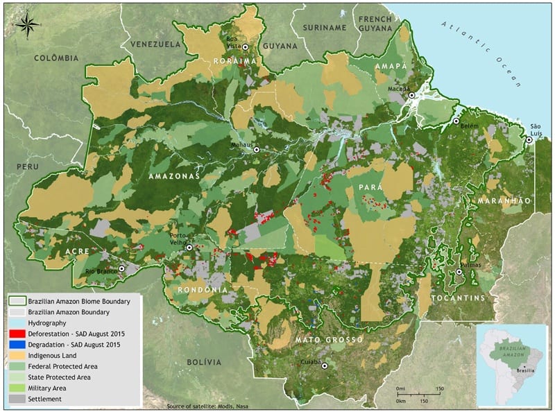


In August 2015, SAD detected 415 square kilometers of deforestation in the Brazilian Amazon, with a cloud cover of 7% of the territory. That represented a 5% reduction in relation to August 2014, when deforestation totaled 437 square kilometers and cloud cover was at 6%.
In August 2015, deforestation was concentrated in Pará (36%), followed by Mato Grosso (28%), Amazonas (17%), Rondônia (8%), Roraima (5%), Tocantins (5%) and Acre (1%).
Degraded forests totaled 131 square kilometers in August 2015. In relation to August 2014, when forest degradation totaled 319 square kilometers there was a 59% reduction. The great majority (79%) occurred in Mato Grosso, followed by Pará (9%), Rondônia (9%), Roraima (3%) and Amazonas (1%).
Download.
This post was published on 19 de November de 2015
Several authors. System for Monitoring Timber Harvesting (Simex): Mapping of logging in the Brazilian Amazon…
Souza Jr, Carlos M; Marengo, José; Ferreira, Bruno; Ribeiro, Júlia; Schirmbeck, Lucimara W; Schirmbeck, Juliano;…
Several authors. System for Monitoring Timber Harvesting (Simex): Mapping logging in Amazonas State – August…
Several authors. System for Monitoring Timber Harvesting (Simex): Mapping logging in Roraima State – August…
Several authors. System for Monitoring Timber Harvesting (Simex): Mapping logging in Amapá State – August…
Several authors. System for Monitoring Timber Harvesting (Simex): Mapping logging in Pará State - August…