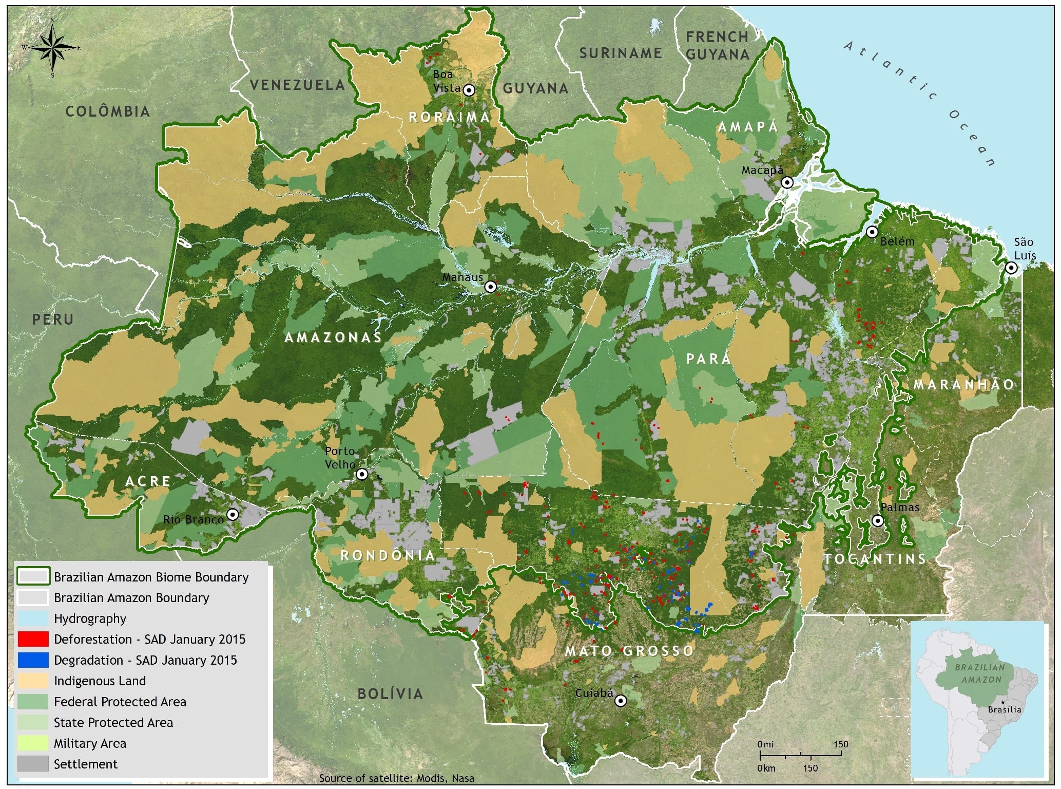


In January 2015, half (50%) of the forest area in the Brazilian Amazon was covered by clouds, a coverage lower than in January 2014 (58%), but which was distributed to a large degree throughout important regions in the Amazon, such as the States of Pará and Amazonas, which reduced the capacity for detecting deforestation and forest degradation in the region. The States with the highest cloud cover were Amapá (89%), Acre (71%) and Roraima (62%). During the period analyzed, and under those cloud conditions, 288 square kilometers of deforestation in the Brazilian Amazon were detected by SAD. That represents a 169% increase in relation to January 2014 when deforestation totaled 107 square kilometers.
In January 2015, deforestation was concentrated in Mato Grosso (75%) and Pará (20%), with a lower occurrence in Rondônia (2%), Amazonas (1%), Tocantins (1%) and Roraima (1%).
Degraded forests in the Brazilian Amazon totaled 389 square kilometers in January 2015. In relation to January 2014, when forest degradation totaled 32 square kilometers there was a 1,116% increase.
This post was published on 23 de February de 2015
Several authors. System for Monitoring Timber Harvesting (Simex): Mapping of logging in the Brazilian Amazon…
Souza Jr, Carlos M; Marengo, José; Ferreira, Bruno; Ribeiro, Júlia; Schirmbeck, Lucimara W; Schirmbeck, Juliano;…
Several authors. System for Monitoring Timber Harvesting (Simex): Mapping logging in Amazonas State – August…
Several authors. System for Monitoring Timber Harvesting (Simex): Mapping logging in Roraima State – August…
Several authors. System for Monitoring Timber Harvesting (Simex): Mapping logging in Amapá State – August…
Several authors. System for Monitoring Timber Harvesting (Simex): Mapping logging in Pará State - August…