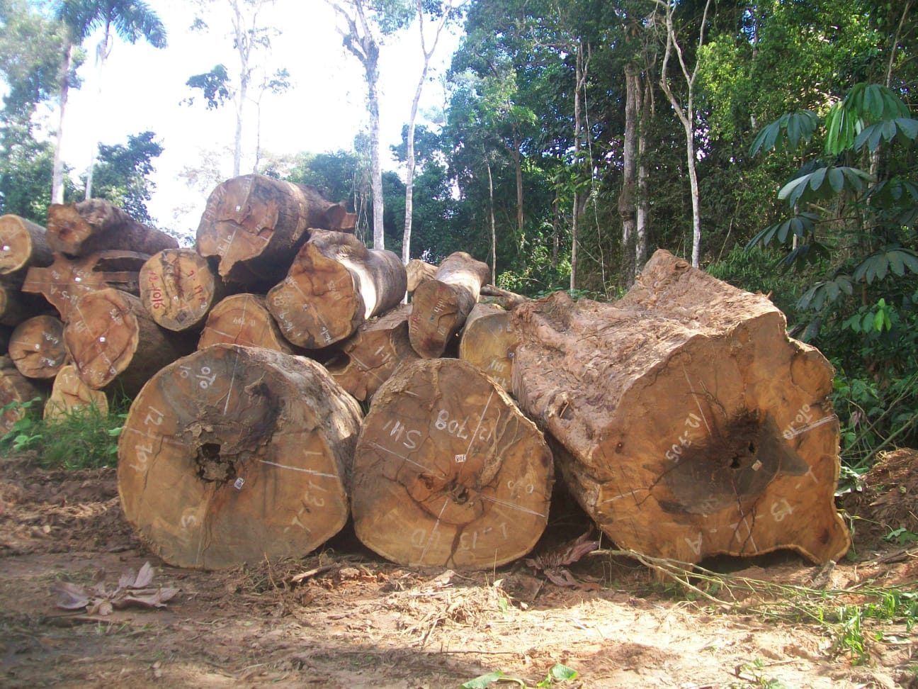
An area equivalent to the city of São Paulo had irregular logging in just one year, 15% within indigenous lands and conservation units
 Logging in the Brazilian Amazon (Photo: Idesam)
A pioneering study shows the percentage of illegal logging in the Brazilian Amazon for the first time. The analysis shows that environmental agencies did not authorize almost 40% of the area with activity detected. And 15% of this irregular timber extraction occurred within protected areas, such as indigenous lands and conservation units.
Published by Simex Network (Imazon, Idesam, Imaflora, and ICV), the study mapped 377,000 hectares with logging in the Amazon between August 2020 and July 2021 through satellite images. It is the first time the organizations have had access to the public data on logging authorizations issued by all state environmental agencies. Last year, only Pará and Mato Grosso released the data necessary for a legality check of logging activity.
With data from Acre, Amazonas, Rondônia, and Roraima, it was possible to identify 142,000 hectares with illegal logging during the studied period, representing 38% of the total. It means that the Amazon had an area of forest equivalent to the city of São Paulo affected by illegal timber exploration in just one year.
“This rate of illegality is very high and represents serious socio-environmental damage to the Amazon, which contributes to preventing sustainable development in the region. Without authorized management plans, there is a higher risk of forest damage and conflicts. It also does not generate formal jobs and collect taxes”, says Dalton Cardoso, a researcher at Imazon.
| Authorized | Non-authorized | Total | ||
| 235,196 | 62% | 142,428 | 38% | 377,624 |
Protected areas had 21,000 hectares invaded
Unauthorized logging needs to be tackled urgently, especially in protected territories. Indigenous lands and conservation units have had 21,000 hectares invaded by illegal loggers between August 2020 and July 2021, an area the size of João Pessoa city. It also corresponds to 15% of the entire area with irregular activity mapped in the Amazon in the period.
| Land category | Area | % |
| Private rural state | 102,003 | 72% |
| Indigenous land | 16,211 | 11% |
| Land void | 13,497 | 9% |
| Conservation unit | 5,178 | 4% |
| Rural settlements | 4,496 | 3% |
| Public land yet to be destined | 1,044 | 1% |
| TOTAL | 142,428 | 100% |
The worst affected indigenous territory was Aripuanã, in Mato Grosso, with more than 4,000 hectares illegally logged. Last month, a federal police officer died during an operation on the indigenous land when he was approaching a truck with illegal wood.
| State | Protected area type | Name | Area |
| MT | IL | Aripuanã | 4,039 |
| AM | IL | Tenharim Marmelos | 3,509 |
| MT | IL | Xingu Park | 1,790 |
| MT | SUCU | Guariba-Roosevelt Extractivist Reserve | 1,398 |
| PA | IL * | Amanayé | 1,255 |
| MT | IPCU | Rio Roosevelt Ecological Station | 1,250 |
| MT | IL | Kawahiva do Rio Pardo | 1,075 |
| AM | IPCU | Campos Amazônicos National Park | 1,026 |
| MT | IL | Zoró | 947 |
| MT | IPCU | Tucumã State Park | 912 |
* To be homologated
IL – Indigenous Land
IPCU – Integral Protection Conservation Unit
SUCU – Sustainable Use Conservation Unit
More than 70% of illegal extraction happens in Mato Grosso
Seven of ten hectares of forests with illegal logging are in Mato Grosso. Between August 2020 and July 2021, irregular activity covered 103,000 hectares in the state, representing 73% of the unauthorized timber extraction in the Amazon region.
Mato Grosso also harbors the same percentage of legally explored areas in the Brazilian Amazon. In the analyzed period, the state had 173,000 hectares with permitted logging.
“Although most of the logging in Mato Grosso has been authorized, the area with illegal activity grew 17% compared to the previous survey, which analyzed the period from August 2019 to July 2020. Only on indigenous lands in the state, there was a 70% increase in illegal lumber extraction”, warns Vinícius Silgueiro, coordinator of Territorial Intelligence at ICV.
The second place with the largest logging area in the Amazon is Pará, with 57,000 hectares (15%). Rondônia, Amazonas, Acre, and Roraima had areas below 20,000 hectares affected by the activity, percentages below 4% of the region’s map.
The study did not analyze satellite data from the remaining three states of the Legal Amazon. Amapá had high cloud cover, and Tocantins and Maranhão had too small areas for the activity.
| State | Area | % |
| MT | 277,048 | 73,4% |
| PA | 57,079 | 15,1% |
| RO | 16,377 | 4,3% |
| AM | 14,976 | 4,0% |
| AC | 10,886 | 2,9% |
| RR | 1,258 | 0,3% |
| TOTAL | 377.624 | 100,0% |
