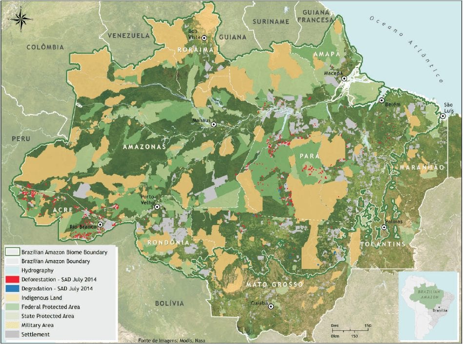


In July 2014, SAD detected 355 square kilometers of deforestation in the Brazilian Amazon with cloud cover of 10% over the territory. That represented a 134% increase in relation to July 2013, when o deforestation totaled 152 square kilometers and the cloud cover was 8%.
The deforestation accumulated during the period of August 2013 to July 2014, corresponding to the twelve months of the current deforestation calendar, totaled 2,044 square kilometers. There was a 2% increase in accumulated deforestation in relation to the previous period (August 2012 to July 2013) when deforestation totaled 2,007 square kilometers.
In July 2014, the majority (57%) of deforestation occurred in Pará, followed by Acre (21%), Amazonas (10%), Mato Grosso (9%), Amapá (1%), Rondônia (1%) and Roraima (1%).
Degraded forests totaled 97 square kilometers in July 2014. In relation to July 2013, when forest degradation totaled 93 square kilometers, there was an increase of 5%. The great majority (81%) occurred in Mato Grosso, followed by Pará (19%).
Forest degradation accumulated during the period of August 2013 to July 2014 totaled 711 square kilometers. There was a 54 % reduction in relation to the previous period (August 2012 to July 2013) when forest degradation totaled 1,555 square kilometers.
Download
This post was published on 19 de August de 2014
Several authors. System for Monitoring Timber Harvesting (Simex): Mapping of logging in the Brazilian Amazon…
Souza Jr, Carlos M; Marengo, José; Ferreira, Bruno; Ribeiro, Júlia; Schirmbeck, Lucimara W; Schirmbeck, Juliano;…
Several authors. System for Monitoring Timber Harvesting (Simex): Mapping logging in Amazonas State – August…
Several authors. System for Monitoring Timber Harvesting (Simex): Mapping logging in Roraima State – August…
Several authors. System for Monitoring Timber Harvesting (Simex): Mapping logging in Amapá State – August…
Several authors. System for Monitoring Timber Harvesting (Simex): Mapping logging in Pará State - August…