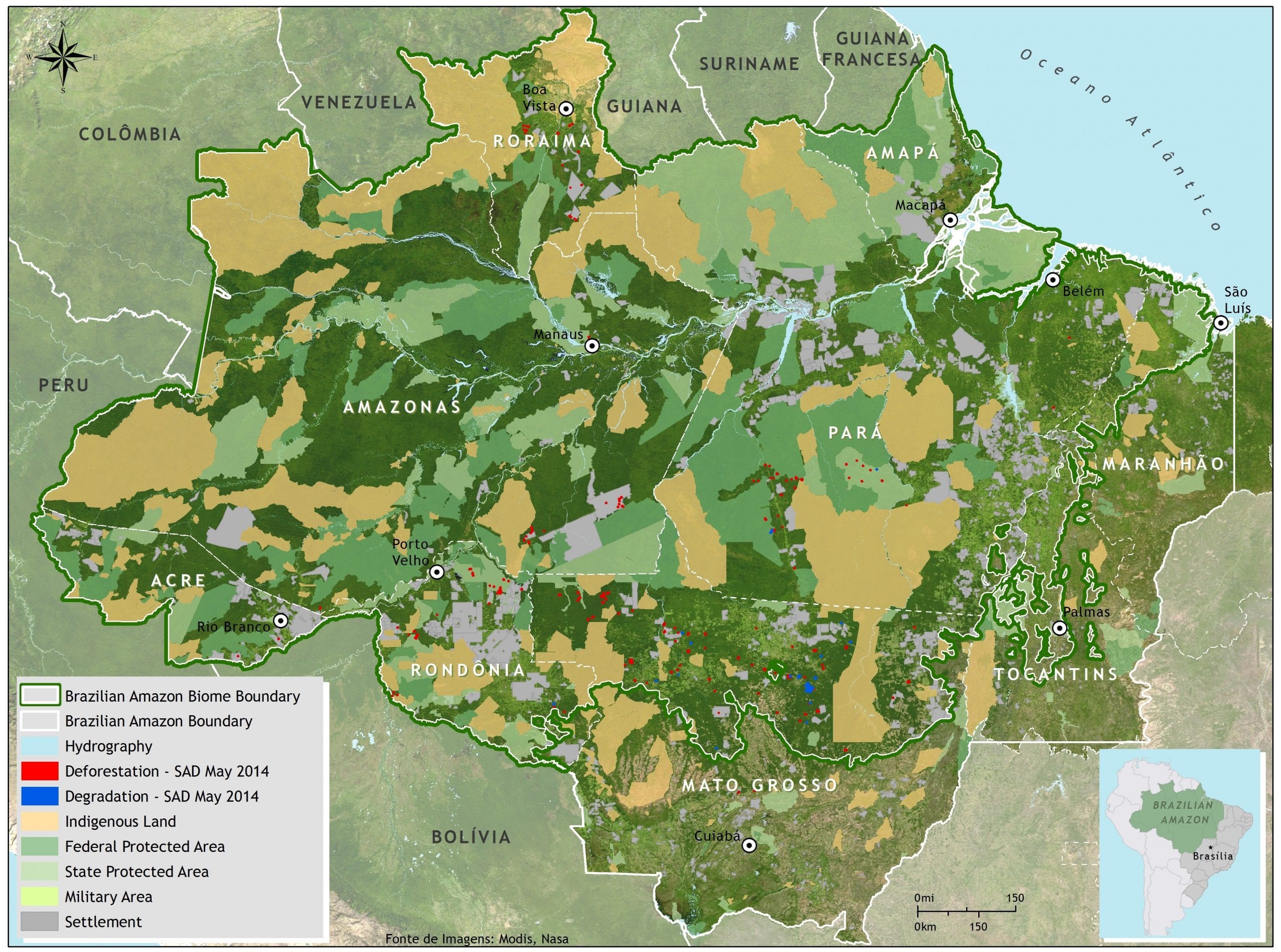


In May 2014, SAD detected 185 square kilometers of deforestation in the Brazilian Amazon with a cloud cover of 38% over the territory. That represented a 119% increase in relation to May 2013 when deforestation totaled 84 square kilometers and cloud cover was at 46%.
The deforestation accumulated during the period of August 2013 to May 2014, corresponding to the first nine ten months of the current deforestation calendar, totaled 846 square kilometers. There was a 49% reduction in accumulated deforestation in relation to the previous period (August 2012 to May 2013) when deforestation totaled 1,654 square kilometers.
In May 2014, the majority (56%) of deforestation occurred in Mato Grosso, followed by Pará (21%), Rondônia (10%), Amazonas (8%), Roraima (8%) and Acre (1%).
Degraded forests totaled 159 square kilometers in May 2014. In relation to May 2013, when forest degradation totaled 75 square kilometers, there was an increase of 113%. The great majority (94%) occurred in Mato Grosso, followed by Pará (5) and Rondônia (1%) and Roraima (1%).
Forest degradation accumulated during the period of August 2013 to May 2014 totaled 566 square kilometers. There was a 56 % reduction in relation to the previous period (August 2012 to May 2013) when forest degradation totaled 1,293 square kilometers.
Baixe aqui o arquivo
This post was published on 24 de July de 2014
Several authors. System for Monitoring Timber Harvesting (Simex): Mapping of logging in the Brazilian Amazon…
Souza Jr, Carlos M; Marengo, José; Ferreira, Bruno; Ribeiro, Júlia; Schirmbeck, Lucimara W; Schirmbeck, Juliano;…
Several authors. System for Monitoring Timber Harvesting (Simex): Mapping logging in Amazonas State – August…
Several authors. System for Monitoring Timber Harvesting (Simex): Mapping logging in Roraima State – August…
Several authors. System for Monitoring Timber Harvesting (Simex): Mapping logging in Amapá State – August…
Several authors. System for Monitoring Timber Harvesting (Simex): Mapping logging in Pará State - August…