


| Título | An alternative approach for detecting and monitoring selectively logged forests in the Amazon |
| Autores | Paulo Barreto |
| Ano de publicação | 2000 |
| DOI | https://doi.org/10.1080/014311600211064 |
Souza Jr, C., & Barreto, P. 2000. An alternative approach for detecting and monitoring selectively logged forests in the Amazon. International Journal of Remote Sensing, 21(1), 173-179. Taylor & Francis.
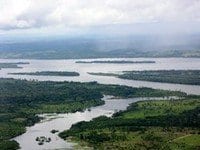
A methodology is presented for estimating the area affected by selective logging in Amazonia’s terra firme forests. Areas of land cleared for temporarily storing logs in the forest (log landings) were detected within soil fraction images derived from linear mixture models of forested areas. Based on field data, a 180m timber extraction radius was assumed for all log landings. The extraction area calculated for detected log landings provides an estimate of the area potentially affected by logging. The resultant image classifications revealed excellent agreement with field data. This methodology can be a powerful tool for the monitoring and control of logging in the Amazon.
This post was published on 14 de junho de 2000
Amorim, L., Ferreira, R., Dias, M., Souza Jr., C., & Veríssimo, A. Sistema de Alerta…
Título Índice de Progresso Social Brasil 2025 Autores Melissa Wilm Daniel Santos Beto Veríssimo Marcelo…
Amorim, L., Ferreira, R., Dias, M., Souza Jr., C., & Veríssimo, A. Sistema de Alerta…
Título Relatório Anual do Desmatamento no Brasil - RAD2024 Autores Carolina Del Lama Julia Shimbo…
Título Fatos da Amazônia 2025 Autores Daniel Santos Manuele Lima Agatha Vilhena Beto Veríssimo Caíque…
Amorim, L., Ferreira, R., Dias, M., Souza Jr., C., & Veríssimo, A. Sistema de Alerta…