


Vários autores. Destaques do Mapeamento Anual de Cobertura e Uso da Terra na Amazônia entre 1985 e 2021. MapBiomas e Raisg, 2023.
A seguinte publicação é o fact sheet em inglês da Coleção 4 do MapBiomas Amazônia, realizado pelo MapBiomas e pela Raisg, onde foram reunidos os principais destaques do monitoramento disponível na plataforma MapBiomas Amazônia.
This post was published on 9 de agosto de 2023

Título Índice de Progresso Social Brasil 2025 Autores Melissa Wilm Daniel Santos Beto Veríssimo Marcelo…
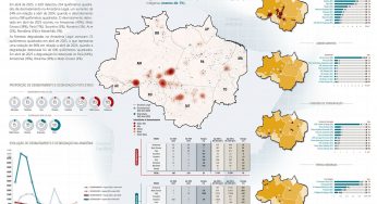
Amorim, L., Ferreira, R., Dias, M., Souza Jr., C., & Veríssimo, A. Sistema de Alerta…
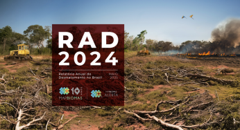
Título Relatório Anual do Desmatamento no Brasil - RAD2024 Autores Carolina Del Lama Julia Shimbo…

Título Fatos da Amazônia 2025 Autores Daniel Santos Manuele Lima Agatha Vilhena Beto Veríssimo Caíque…
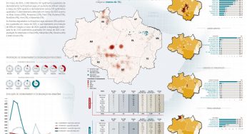
Amorim, L., Ferreira, R., Dias, M., Souza Jr., C., & Veríssimo, A. Sistema de Alerta…
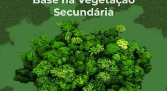
Título A Vocação da Restauração Florestal na Amazônia com Base na Vegetação Secundária Autores Jayne…

