Mapping unofficial roads with Landsat imagens: a new tool to improve the monitoring of the Brazilian Amazon rainforest.

facebook - Mapping unofficial roads with Landsat imagens: a new tool to improve the monitoring of the Brazilian Amazon rainforest.facebook - Mapping unofficial roads with Landsat imagens: a new tool to improve the monitoring of the Brazilian Amazon rainforest.linkedin - Mapping unofficial roads with Landsat imagens: a new tool to improve the monitoring of the Brazilian Amazon rainforest.linkedin - Mapping unofficial roads with Landsat imagens: a new tool to improve the monitoring of the Brazilian Amazon rainforest.whatsapp - Mapping unofficial roads with Landsat imagens: a new tool to improve the monitoring of the Brazilian Amazon rainforest.whatsapp - Mapping unofficial roads with Landsat imagens: a new tool to improve the monitoring of the Brazilian Amazon rainforest.x - Mapping unofficial roads with Landsat imagens: a new tool to improve the monitoring of the Brazilian Amazon rainforest.x - Mapping unofficial roads with Landsat imagens: a new tool to improve the monitoring of the Brazilian Amazon rainforest.a2a - Mapping unofficial roads with Landsat imagens: a new tool to improve the monitoring of the Brazilian Amazon rainforest.a2a - Mapping unofficial roads with Landsat imagens: a new tool to improve the monitoring of the Brazilian Amazon rainforest.


Título Mapping unofficial roads with Landsat imagens: a new tool to improve the monitoring of the Brazilian Amazon rainforest.
Autores O. Brandão Jr.

C. M. Souza Jr.

Ano de publicação 2006
DOI https://doi.org/10.1080/01431160500353841

Brandão Jr, A., & Souza Jr., C. 2006. Mapping unofficial roads with Landsat images: a new tool to improve the monitoring of the Brazilian Amazon rainforest. International Journal of Remote Sensing, 27(1), 177-189. Taylor & Francis.

Abstract

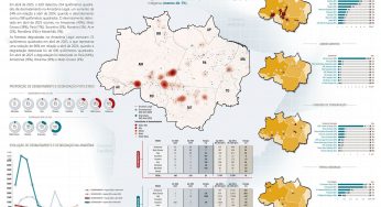
Landsat images were used to identify, map and quantify roads in the Amazon region. The mapping was carried out in the Central‐West region of the State of Pará, between 1985 and 2001. A total of 25 196 km of roads were mapped, including 20 769 km of unofficial roads—roads built without governmental incentives. The average growth rate for unofficial roads almost doubled in 10 years, going from 9.85 km/10 000 km2 per year, between 1990 and 1995, to 19.25 km/10 000 km2 per year between 1996 and 2001. Growth rate was most significant in the regions of São Félix do Xingu, Santarém and Novo Progresso with average rates higher than 40 km/10 000 km2 per year between 1996 and 2001. The methodology proposed can improve monitoring in the Brazilian Amazon, by prioritising areas for law enforcement, and land titling and identifying priority regions for creating protected areas.

facebook - Mapping unofficial roads with Landsat imagens: a new tool to improve the monitoring of the Brazilian Amazon rainforest.facebook - Mapping unofficial roads with Landsat imagens: a new tool to improve the monitoring of the Brazilian Amazon rainforest.linkedin - Mapping unofficial roads with Landsat imagens: a new tool to improve the monitoring of the Brazilian Amazon rainforest.linkedin - Mapping unofficial roads with Landsat imagens: a new tool to improve the monitoring of the Brazilian Amazon rainforest.whatsapp - Mapping unofficial roads with Landsat imagens: a new tool to improve the monitoring of the Brazilian Amazon rainforest.whatsapp - Mapping unofficial roads with Landsat imagens: a new tool to improve the monitoring of the Brazilian Amazon rainforest.x - Mapping unofficial roads with Landsat imagens: a new tool to improve the monitoring of the Brazilian Amazon rainforest.x - Mapping unofficial roads with Landsat imagens: a new tool to improve the monitoring of the Brazilian Amazon rainforest.a2a - Mapping unofficial roads with Landsat imagens: a new tool to improve the monitoring of the Brazilian Amazon rainforest.a2a - Mapping unofficial roads with Landsat imagens: a new tool to improve the monitoring of the Brazilian Amazon rainforest.

This post was published on 5 de junho de 2006

AddThis Website Tools

Notícias recentes

Índice de Progresso Social Brasil 2025Índice de Progresso Social Brasil 2025

Índice de Progresso Social Brasil 2025

Título Índice de Progresso Social Brasil 2025 Autores Melissa Wilm Daniel Santos Beto Veríssimo Marcelo…

29 de maio de 2025
Sistema de Alerta de Desmatamento (SAD) – Abril de 2025Sistema de Alerta de Desmatamento (SAD) – Abril de 2025

Sistema de Alerta de Desmatamento (SAD) – Abril de 2025

Amorim, L., Ferreira, R., Dias, M., Souza Jr., C., & Veríssimo, A. Sistema de Alerta…

29 de maio de 2025
Relatório Anual do Desmatamento no Brasil – RAD2024Relatório Anual do Desmatamento no Brasil – RAD2024

Relatório Anual do Desmatamento no Brasil – RAD2024

Título Relatório Anual do Desmatamento no Brasil - RAD2024 Autores Carolina Del Lama Julia Shimbo…

15 de maio de 2025

Fatos da Amazônia 2025

Título Fatos da Amazônia 2025 Autores Daniel Santos Manuele Lima Agatha Vilhena Beto Veríssimo Caíque…

30 de abril de 2025

Sistema de Alerta de Desmatamento (SAD) – Março de 2025

Amorim, L., Ferreira, R., Dias, M., Souza Jr., C., & Veríssimo, A. Sistema de Alerta…

25 de abril de 2025

A Vocação da Restauração Florestal na Amazônia com Base na Vegetação Secundária

Título A Vocação da Restauração Florestal na Amazônia com Base na Vegetação Secundária Autores Jayne…

30 de março de 2025