Parente, Leandro; Taquary, Evandro; Silva, Ana Paula; Souza, Carlos. Ferreira, Laerte. Next Generation Mapping: Combining Deep Learning, Cloud Computing, and Big Remote Sensing Data. Remote Sensing, 3 December 2019. https://doi.org/10.3390/rs11232881
Abstract: The rapid growth of satellites orbiting the planet is generating massive amounts of data for Earth science applications. Concurrently, state-of-the-art deep-learning-based algorithms and cloud computing infrastructure have become available with a great potential to revolutionize the image processing of satellite remote sensing. Within this context, this study evaluated, based on thousands of PlanetScope images obtained over a 12-month period, the performance of three machine learning approaches (random forest, long short-term memory-LSTM, and U-Net). We applied these approaches to mapped pasturelands in a Central Brazil region. The deep learning algorithms were implemented using TensorFlow, while the random forest utilized the Google Earth Engine platform. The accuracy assessment presented F1 scores for U-Net, LSTM, and random forest of, respectively, 96.94%, 98.83%, and 95.53% in the validation data, and 94.06%, 87.97%, and 82.57% in the test data, indicating a better classification efficiency using the deep learning approaches. Although the use of deep learning algorithms depends on a high investment in calibration samples and the generalization of these methods requires further investigations, our results suggest that the neural network architectures developed in this study can be used to map large geographic regions that consider a wide variety of satellite data (e.g., PlanetScope, Sentinel-2, Landsat-8).
This post was published on 3 de dezembro de 2019
Amorim, L., Ferreira, R., Dias, M., Souza Jr., C., & Veríssimo, A. Sistema de Alerta…

Título Índice de Progresso Social Brasil 2025 Autores Melissa Wilm Daniel Santos Beto Veríssimo Marcelo…
Amorim, L., Ferreira, R., Dias, M., Souza Jr., C., & Veríssimo, A. Sistema de Alerta…
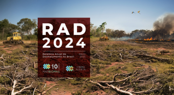
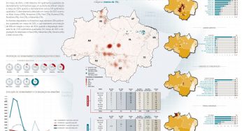
Título Relatório Anual do Desmatamento no Brasil - RAD2024 Autores Carolina Del Lama Julia Shimbo…

Título Fatos da Amazônia 2025 Autores Daniel Santos Manuele Lima Agatha Vilhena Beto Veríssimo Caíque…
Amorim, L., Ferreira, R., Dias, M., Souza Jr., C., & Veríssimo, A. Sistema de Alerta…