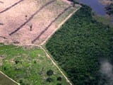
Use of Formosat-2 satellite imagery to detect near real time deforestation in Amazonia.

facebook - Use of Formosat-2 satellite imagery to detect near real time deforestation in Amazonia.facebook - Use of Formosat-2 satellite imagery to detect near real time deforestation in Amazonia.linkedin - Use of Formosat-2 satellite imagery to detect near real time deforestation in Amazonia.linkedin - Use of Formosat-2 satellite imagery to detect near real time deforestation in Amazonia.whatsapp - Use of Formosat-2 satellite imagery to detect near real time deforestation in Amazonia.whatsapp - Use of Formosat-2 satellite imagery to detect near real time deforestation in Amazonia.x - Use of Formosat-2 satellite imagery to detect near real time deforestation in Amazonia.x - Use of Formosat-2 satellite imagery to detect near real time deforestation in Amazonia.a2a - Use of Formosat-2 satellite imagery to detect near real time deforestation in Amazonia.a2a - Use of Formosat-2 satellite imagery to detect near real time deforestation in Amazonia.

artigocie29 150x120 - Use of Formosat-2 satellite imagery to detect near real time deforestation in Amazonia.artigocie29 150x120 - Use of Formosat-2 satellite imagery to detect near real time deforestation in Amazonia.Baillarin, F., Gonzales, G., & Souza Jr., C. (2008). Use of Formosat-2 satellite imagery to detect near real time deforestation in Amazonia. 2008 IEEE International Geoscience & Remote Sensing Symposium. Boston, Massachusetts: IEEE International.

facebook - Use of Formosat-2 satellite imagery to detect near real time deforestation in Amazonia.facebook - Use of Formosat-2 satellite imagery to detect near real time deforestation in Amazonia.linkedin - Use of Formosat-2 satellite imagery to detect near real time deforestation in Amazonia.linkedin - Use of Formosat-2 satellite imagery to detect near real time deforestation in Amazonia.whatsapp - Use of Formosat-2 satellite imagery to detect near real time deforestation in Amazonia.whatsapp - Use of Formosat-2 satellite imagery to detect near real time deforestation in Amazonia.x - Use of Formosat-2 satellite imagery to detect near real time deforestation in Amazonia.x - Use of Formosat-2 satellite imagery to detect near real time deforestation in Amazonia.a2a - Use of Formosat-2 satellite imagery to detect near real time deforestation in Amazonia.a2a - Use of Formosat-2 satellite imagery to detect near real time deforestation in Amazonia.

This post was published on 26 de junho de 2012

AddThis Website Tools

Notícias recentes

Sistema de Alerta de Desmatamento (SAD) – Maio de 2025

Amorim, L., Ferreira, R., Dias, M., Souza Jr., C., & Veríssimo, A. Sistema de Alerta…

2 de julho de 2025

Índice de Progresso Social Brasil 2025

Título Índice de Progresso Social Brasil 2025 Autores Melissa Wilm Daniel Santos Beto Veríssimo Marcelo…

29 de maio de 2025

Sistema de Alerta de Desmatamento (SAD) – Abril de 2025

Amorim, L., Ferreira, R., Dias, M., Souza Jr., C., & Veríssimo, A. Sistema de Alerta…

29 de maio de 2025

Relatório Anual do Desmatamento no Brasil – RAD2024

Título Relatório Anual do Desmatamento no Brasil - RAD2024 Autores Carolina Del Lama Julia Shimbo…

15 de maio de 2025

Fatos da Amazônia 2025

Título Fatos da Amazônia 2025 Autores Daniel Santos Manuele Lima Agatha Vilhena Beto Veríssimo Caíque…

30 de abril de 2025

Sistema de Alerta de Desmatamento (SAD) – Março de 2025

Amorim, L., Ferreira, R., Dias, M., Souza Jr., C., & Veríssimo, A. Sistema de Alerta…

25 de abril de 2025