| Título | The role of remote sensing and GIS in enforcement of areas of permanent preservation in the Brazilian Amazon |
| Autores | Laurel A. Firestone Carlos Souza Jr. |
| Ano de publicação | 2002 |
| DOI | https://doi.org/10.1080/10106040208542235 |
Firestone, L., & Souza Jr, C. 2002. The Role of Remote Sensing and GIS in Enforcement of Areas of Permanent Preservation in the Brazilian Amazon. Geocarto International, 17(2), 53 – 58.
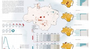
Neste estudo, Firestone e Souza Jr. elaboram um sistema de detecção de Áreas de Preservação Permanente degradadas ao longo de rios e igarapés utilizando imagens Landsat e SIG. A metodologia foi testada em um centro madeireiro na Amazônia Oriental. Os dados produzidos incluem mapa da cobertura florestal, mapa de rios, mapa de Áreas de Preservação Permanente e mapa de violação da lei. Esta metodologia permite que todos os dados sejam extraídos da imagem de satélite (rios e cobertura vegetal) e que as violações (áreas degradadas) sejam detectadas automaticamente. O sistema detectou violações da lei em 60% de todas as Áreas de Preservação Permanente desmatadas, apresentando 88,6% de acurácia – o que revela a viabilidade da monitoração eficiente para o cumprimento da lei na Amazônia.
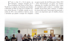
This post was published on 13 de junho de 2002
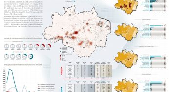
Amorim, L., Ferreira, R., Dias, M., Souza Jr., C., & Veríssimo, A. Sistema de Alerta…

Título Índice de Progresso Social Brasil 2025 Autores Melissa Wilm Daniel Santos Beto Veríssimo Marcelo…
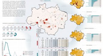
Amorim, L., Ferreira, R., Dias, M., Souza Jr., C., & Veríssimo, A. Sistema de Alerta…
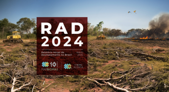
Título Relatório Anual do Desmatamento no Brasil - RAD2024 Autores Carolina Del Lama Julia Shimbo…

Título Fatos da Amazônia 2025 Autores Daniel Santos Manuele Lima Agatha Vilhena Beto Veríssimo Caíque…
Amorim, L., Ferreira, R., Dias, M., Souza Jr., C., & Veríssimo, A. Sistema de Alerta…